
Africa in miniature
Black sand beaches, an active volcano, equatorial forest, crater lakes, savannahs and the Sahel: Cameroon brings together almost every face of the continent in a single country.
Start the journeyPhoto : Blaizo 237, CC BY-SA 4.0
- 402 kmof Atlantic coastline
- 4,040 mat the summit of Mount Cameroon
- 10,300 mmof rain a year at Debundscha, at the foot of the volcano
- 900bird species
Why the nickname?
Cameroon owes this nickname to its diversity: climates, relief, landscapes, but also peoples, languages and cultures. In just over 1,000 km from south to north, you go from mangrove to steppe, and from an equatorial to a Sahelian climate.
The journey below travels up the country in six stages, from the ocean to Lake Chad.

The Atlantic coast
Climate — Equatorial and very wet: Douala gets about 3,600 mm of rain a year, more than five times what falls on London.
Photo : Blaizo 237, CC BY-SA 4.0
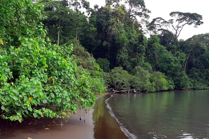
Cameroon opens onto the Gulf of Guinea along 402 km of coastline. A plain 20 to 80 km wide, covered with dense forest and mangroves, separates the ocean from the interior.
Seven kilometres south of Kribi, the Lobé Falls have a rare feature: the river pours straight into the ocean. In the rainy season, they can reach 300 m across.
Further north, in Limbe, the beaches are black: the sand comes from the volcanic rock of nearby Mount Cameroon.
Who lives here
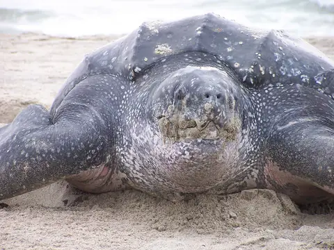
Leatherback turtleDermochelys coriaceaAlong with the olive ridley, it comes to nest on the beaches of Ebodjé, south of Kribi, from October to April. At night, village fishermen watch over the nests to protect the eggs.Photo taken outside Cameroon. David Rabon, U.S. Fish and Wildlife Service, Domaine public 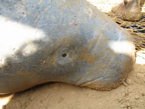
African manateeTrichechus senegalensisThis large, threatened aquatic mammal is the emblem of Lake Ossa, near Edéa. The lake has been a wildlife reserve since 1968.Photo location not stated. Lucy Keith-Diagne, CC BY 4.0
On this site : Kribi · Limbé · Douala · Poisson braisé · Ndolé · Kwacoco et banga

Mount Cameroon
Climate — From the humid heat of the seashore to the cold of the summit. At Debundscha, on its western side, an average of 10,300 mm of rain falls each year: one of the wettest places on Earth.
Photo : Eric Joel Mama Nke, CC BY-SA 4.0
The Duala call it Mongo ma Ndemi, "the mountain of greatness"; it is also known as Fako. This active volcano rises to 4,040 m according to most sources (some give 4,095 m). It is one of the most active volcanoes in Africa.
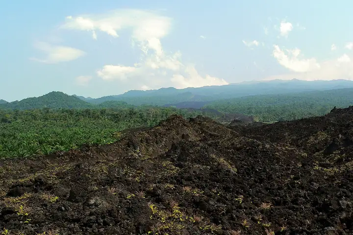
It erupted in 1999, in 2000, then briefly in February 2012. In 1999, a lava flow cut the road from Limbe to Idenau and stopped a few metres from a hotel.
Its slopes have been a national park since 2009. Two bird species live nowhere else, including the Mount Cameroon spurfowl. To the north, the Korup and Takamanda forests are home to the Cross River gorilla: only 200 to 250 remain, making it the most endangered gorilla subspecies.
Who lives here
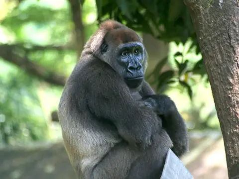
Cross River gorillaGorilla gorilla diehliIt lives along the Nigerian border, mainly in Takamanda National Park. The Limbe centre houses the only one known in captivity.Photo location not stated. Julielangford, CC BY-SA 3.0 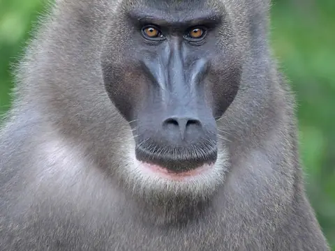
DrillMandrillus leucophaeusA cousin of the mandrill, this black-faced monkey lives in the forests between the Cross River and the Sanaga, Korup among them.Photo taken in a park in France. Clément Bardot, CC BY-SA 4.0
On this site : Limbé · Eru · Kwacoco et banga · Koki

The equatorial forest
Climate — Equatorial: hot and humid all year round.
Photo : Sidoine Mbogni, CC BY-SA 4.0
In the south, the plateau stands at 500 to 600 m on average and disappears under tropical forest. Here the country borders the Congo Basin, the world's second-largest tropical forest.
The Dja Reserve, a UNESCO World Heritage Site since 1987, is one of the largest and best-protected rainforests in Africa: 90% of its area remains untouched. It has 14 primate species, including the western lowland gorilla and the chimpanzee.
In the far south-east, Lobéké National Park has marshy clearings, the bais, where elephants and gorillas gather at some of the highest densities in Africa. It is part of the Sangha Trinational, shared with the Central African Republic and Congo and listed by UNESCO in 2012.
Who lives here
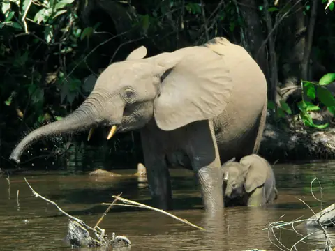
Forest elephantLoxodonta cyclotisSmaller than its savannah cousin, it visits the bais of Lobéké and the Dja Reserve. Poaching for ivory still threatens it.Photo taken in neighbouring Congo. Thomas Breuer, CC BY 2.5 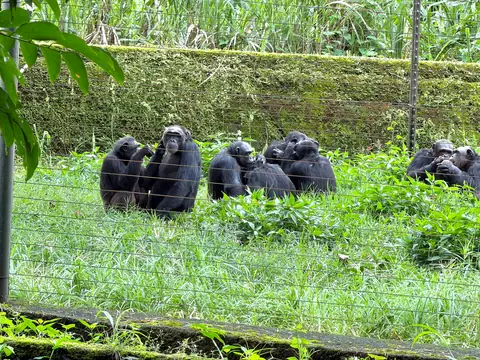
ChimpanzeePan troglodytesFound in the Dja as well as in the forests of the South-West. These ones live at the Limbe Wildlife Centre.Photo taken at the Limbe Wildlife Centre. OkandaLizette, CC BY-SA 4.0 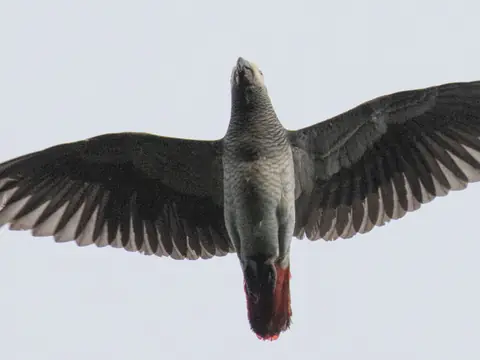
Grey parrotPsittacus erithacusRecognisable by its red tail, it is among the notable wildlife of the Dja Reserve.avocat, CC BY 4.0

The Western Highlands
Climate — Altitude cools the air: the sticky heat of the coast gives way to milder hills.
Photo : Nickaj, Domaine public
A long chain of mountains and volcanoes runs across the country, from the Gulf of Guinea northwards. In the west, it forms the Bamiléké and Bamenda highlands, dotted with crater lakes.
Around Lake Oku, the Kilum-Ijim forest is the largest montane forest still standing in West Africa.
These volcanic lakes can be dangerous. On 21 August 1986, Lake Nyos suddenly released a huge amount of carbon dioxide stored in its depths. Heavier than air, the cloud rolled down the valleys and killed between 1,700 and 1,800 people in their sleep.
Who lives here
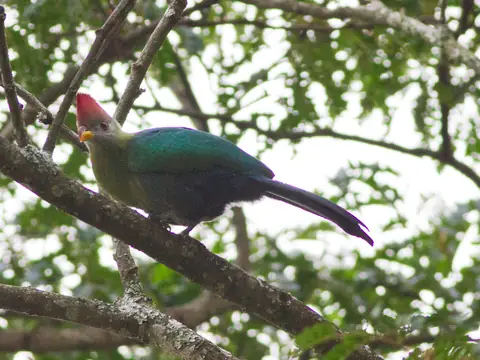
Bannerman's turacoTauraco bannermaniThis red-crested bird lives only in Cameroon. Over 80% of its range lies on Mount Oku alone, its last stronghold.Ron Knight, CC BY 2.0
On this site : Nkui · Taro à la sauce jaune · Kondrè

Adamawa and the savannahs
Climate — Tropical, with a real dry season. Garoua gets only about 1,000 mm of rain a year, nearly four times less than Douala.
Photo : Marie Barbara, CC BY-SA 4.0
The Adamawa plateau, 1,000 m high on average, bars the country from west to east and separates the South from the North. It is called Cameroon's "water tower": many of the country's rivers rise here.
It is cattle country: livestock is the main activity, and the region supplies over a third of national production. About fifteen kilometres from Ngaoundéré, the Vina Falls drop off the plateau.
Further north, between Ngaoundéré and Garoua, Bénoué National Park protects wooded savannah. A wildlife reserve from 1932 and a national park since 1968, it is known for its hippos.
Who lives here
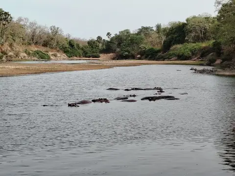
HippopotamusHippopotamus amphibiusIn the dry season, they gather in the pools of the Bénoué. A study measured the decline of their population in the park between 1976 and 2013.Oumarou OB, CC0 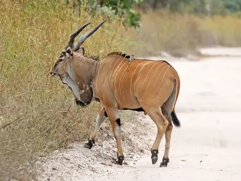
Giant elandTaurotragus derbianusThe largest of all antelopes. When the river drops, giant elands join buffalo and hartebeest around the Bénoué's waterholes.Photo taken in Senegal. Charles J. Sharp, CC BY-SA 4.0

The Sahel and Lake Chad
Climate — Sahelian: the driest part of the country. Forest has given way to scrub savannah and plains.
Photo : 2ddanga, CC BY-SA 4.0
The Mandara Mountains, a volcanic range on the Nigerian border, raise basalt spires around Rhumsiki, the remains of ancient volcanoes. The most famous, Kapsiki Peak, reaches 1,224 m. Many travellers describe a lunar landscape.
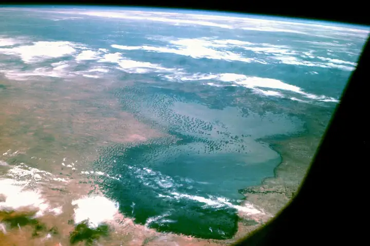
At the very top, Cameroon shares Lake Chad with Chad, Niger and Nigeria. Its surface shrank from about 25,000 km² in 1963 to 1,350 km². According to recent studies, it has been stable or slightly growing for some twenty years.
In between, Waza National Park covers 1,700 km² of savannah and floodplains. It used to be one of the most renowned parks in French-speaking Africa.
Who lives here
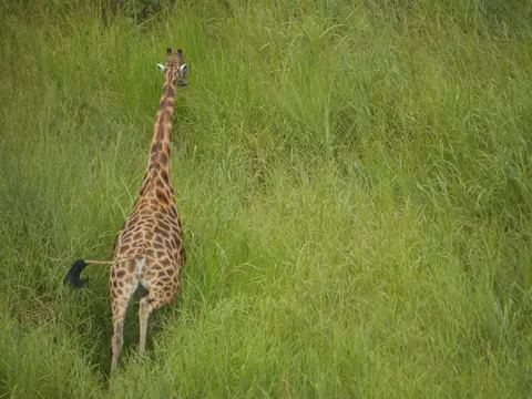
Kordofan giraffeGiraffa camelopardalis antiquorumCritically endangered. An aerial survey in 2022–2023 counted at least 358 in Waza.Photo taken in the Democratic Republic of the Congo. Matthew Luizza, U.S. Fish and Wildlife Service, Domaine public 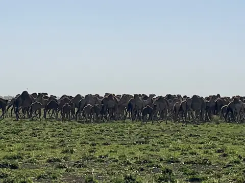
DromedaryCamelus dromedariusA domestic animal of Sahel herders, it is seen in herds on the northern edges of Waza National Park.Adesolive, CC BY-SA 4.0
Waza was famous for its roughly 1,000 elephants, guaranteed sightings in the dry season. The 2022–2023 aerial survey detected none. Only ten to twenty lions are thought to remain, completely isolated. Insecurity, shrinking budgets and poaching explain the decline.
On this site : Couscous de mil · Sauce tasba · Sauce aux feuilles de baobab · Bili-bili
The country in five great environments
- Coast and volcano
- Equatorial forest
- Highlands
- Plateau and savannahs
- Sahel
Simplified map: each administrative region takes the colour of its dominant environment. In reality, environments ignore borders: the forest spills into the Littoral, the savannah into the Centre and East.
A natural heritage to protect
Cameroon is home to over 9,000 plant species, 900 bird species and nearly 300 mammal species. Several of them are threatened: this journey also shows what could disappear.
- over 9,000plant species
- 900bird species
- nearly 300mammal species
Photo credits (22)
- Mount Cameroon silhouetted at sunset above the ocean, seen from Douala — Blaizo 237, CC BY-SA 4.0
- Aerial view of the Lobé Falls pouring into the ocean near Kribi — Blaizo 237, CC BY-SA 4.0
- Black sand beach in Limbe — Bernard Dupont, CC BY-SA 2.0
- Head of a leatherback turtle on the sand — David Rabon, U.S. Fish and Wildlife Service, Domaine public
- African manatee — Lucy Keith-Diagne, CC BY 4.0
- The slopes of Mount Cameroon in the national park — Eric Joel Mama Nke, CC BY-SA 4.0
- Black lava flow from the 1999 eruption near Limbe — Bernard Dupont, CC BY-SA 2.0
- Cross River gorilla sitting — Julielangford, CC BY-SA 3.0
- Portrait of a drill — Clément Bardot, CC BY-SA 4.0
- Aerial view of the rainforest at Bodiman, near Yabassi — Sidoine Mbogni, CC BY-SA 4.0
- A forest elephant and her calf in a swamp — Thomas Breuer, CC BY 2.5
- Group of chimpanzees sitting in the grass at the Limbe centre — OkandaLizette, CC BY-SA 4.0
- Grey parrot in flight, red tail spread — avocat, CC BY 4.0
- Lake Oku surrounded by forest, in the North-West — Nickaj, Domaine public
- Bannerman's turaco perched on a branch — Ron Knight, CC BY 2.0
- The Vina Falls near Ngaoundéré — Marie Barbara, CC BY-SA 4.0
- Hippos in the river, Bénoué National Park — Oumarou OB, CC0
- Male giant eland — Charles J. Sharp, CC BY-SA 4.0
- The volcanic spires of the Kapsiki mountains, near Rhumsiki — 2ddanga, CC BY-SA 4.0
- Lake Chad seen from space — NASA, Domaine public
- Kordofan giraffe in tall grass — Matthew Luizza, U.S. Fish and Wildlife Service, Domaine public
- Herd of dromedaries north of Waza National Park — Adesolive, CC BY-SA 4.0
Sources
- Wikipedia — Geography of Cameroon
- Wikipedia — Mount Cameroon
- UNESCO — Réserve de faune du Dja
- UNESCO — Trinational de la Sangha
- Wikipedia — Lobéké National Park
- Wikipédia — Chutes de la Lobé
- Wikipédia — Limbé
- Mongabay — Le lamantin d'Afrique au lac Ossa
- Wikipedia — Takamanda National Park
- Wikipedia — Bannerman's turaco
- Wikipedia — Kilum-Ijim Forest
- Wikipedia — Lake Nyos disaster
- Wikipédia — Région de l'Adamaoua
- Wikipedia — Bénoué National Park
- Oryx — Déclin des hippopotames de la Bénoué (1976-2013)
- Wikipédia — Monts Mandara
- ESA — Lake Chad's shrinking waters
- Mongabay — Lake Chad isn't shrinking
- Wikipedia — Kordofan giraffe
- Lion Recovery Fund — Lions de Waza
- UICN — Country Brief Cameroon